Category

Data

Damage Prevention

Damage Prevention

City infrastructure is constantly expanding and becoming more complex. Recent expansion of networks, such as fiber to the home in North America and Europe, is changing the underground landscape. New infrastructure construction can come into conflict with pre- existing infrastructure and poses serious challenges due to underground congestion.

In order to properly build, manage and maintain utility infrastructure, proper damage prevention procedures are necessary to secure and safeguard all those existing and yet to be installed. Without proper utility damage prevention practices in place, the safety and resources of all stakeholders is put at serious risk.

With any type digging or excavation, there is always the possibility of striking a buried utility such as gas, hydro, and electric. A potential utility strike can cause explosions, flooding, electricity leakage, or most importantly loss of life. These situations are extremely expensive to fix and cause vital service disruptions that can negatively affect all aspects of proper city operation.

 The best way to prevent damage is to have in place a cumulative set of legal processes, proper utility & engineering regulations, and municipal bylaws, that define how utilities are to be installed and maintained, how excavators will abide to protect installed utilities, and how public safety and environment will be protected.

In North America, regulations and damage prevention initiatives have been implemented which define how data is collected, integrated and managed for proper damage prevention.

A tried and tested model to ensure limited damage to utilities includes: Using experience locating service providers, and using One-Call center fully enriched with digital maps.

By adapting a proper safety model, infrastructure can be constructed and managed with the highest degree of safety for the years to come.

Pre-Engineering & Permitting

Pre-Engineering & Permitting

With cities rapidly growing, more and more utilities are being buried underground, creating intricate and complex networks to distribute services or collect waste water.

Consequently, few utility and infrastructure organizations have accurate maps of their distribution networks, making pre-engineering and permitting a daunting task. This lack of digital map integration and route validation results in huge inefficiency, disruption and risk, creating additional costs and delays for stakeholders.

To alleviate these issues, proper digital mapping and pre-engineering processes must be implemented. The primary reason to conduct mapping, pre-engineering, and route validation is to detect and identify the precise location and depth of underground utilities, provide electronic drawings with GPS georeferencing, collect underground utility info & surface base map information, and finally, integrate all data into GIS for access and management capabilities to relate all surface and subsurface elements together.

However, to ensure that all maps and pre-engineering models are accurate, other techniques and technologies used to collect geospatial data must be completed in unison. These technologies and processes include utility locating, hydrovac daylighting, GPS surveying, ground penetrative radar, electronic field drawing, and the use of a portable data collector.

Once all steps have been completed, the final outcome of the mapping and pre-engineering process is a sophisticated, real-time 3D visual representation of underground utility assets. These electronic drawings are perfect for assisting in network design, conflict visualization, excavation and maintenance. This representation is an accurate representation of a validated proposed path for new utility installation.

 Upon creation of the clear route, the results are transferred into an electronic permitting system that enables municipalities to access, evaluate the data and propose modifications on an electronic model, thus expediting the once tedious permitting process of utility construction & installation.

Utility Locating

Utility Locating

Digging & excavation for construction, installation, and maintenance nowadays is no longer an ordinary task, especially in developed cities. It requires high-level accuracy and care because utility pipes and cables may be lying underneath the ground. If you are engaged in a project that involves digging, the best way to avoid damaging buried utilities is to reach out to a reliable utility locating company. This service is required by law in North America when we have to do any type of excavation for the purpose of construction, installation of new utilities or excavating for repairs, and maintenance of existing utilities. Locating is an integral part of subsurface utility engineering and permitting.

Utility locating is a practice in which an individual or team of trained locating technicians utilize a variety of equipment and tools in order to pin point the location of underground utilities before excavation. The ability to identify buried utilities prevents digging accidents and promotes safer excavation. Proper damage prevention processes and underground utility locating has reduced incidents of damaged utilities to less than 5 damages per 1000 excavations.

The most common method of locating utilities, is through the use of Electromagnetic currents. Locating equipment that generates electromagnetic radio frequency, allows the receiver to detect utilities that contain conductive materials. This is a reliable method for locating underground electric, cable, telephone, water, sewer and propane lines. Once a utility is found, it is then marked with paint so that excavators know that a utility is buried in that exact location.

Before locating, it is important that all geospatial data and maps have been integrated into an accessible digital format. This makes locating easier to manage and more efficient for technicians.

While some utilities can be found easily, some can remain hidden due to a variety of circumstances such as induced signals and unclear depths. These types of buried utilities require a very high level of experience to locate with other methods being used to uncover their precise location. On a daily basis, tens of thousands of locates are taking place which require properly trained administrative and management personnel, along with sophisticated software systems.

Hydrovac Daylighting

Hydrovac Daylighting

In today’s climate of awareness and environmental consciousness, Hydrovac daylighting is quickly becoming the excavation method of choice in the utility industry.

Hydrovac Daylighting is the process of removing soil by combining both pressurized water and an air vacuum hose. The pressurized water is used to cut through the ground and break up the soil. The vacuum then lifts the slurry from the excavation area and stores it in a debris tank.

Hydrovac excavation is used primarily for utility daylighting which is the process of unearthing and exposing underground utilities to the light of day.  It is also commonly used for shallow trenching for utility installation and pole placement.

Hydrovac daylighting is the preferred method for excavation in congested areas, such as high traffic roads- it is high speed and facilitates repairs in a variety of areas while providing minimal destruction and interruption.

Hydrovacing reduces the likelihood of puncture damage to utilities, eliminating the possibility of service interruptions and reducing the need for repairs. The primary benefit of hydro excavation is that it provides for better damage and safety control when compared to other mechanical solutions. Combining these factors, hydrovacing is the perfect choice to get projects finished quickly all while limiting the likelihood of accidents.

Before hydrovacing can begin it is important that the excavation area has been properly located and mapped with all geospatial data being integrated into an accessible digital format.

Hydrovac daylighting provides a perfectly non-destructive way to excavate and locate the depth of underground utilities. It is currently the most preferred method of digging because of its low risk and precise accuracy.

Horizontal Directional Drilling

Horizontal Directional Drilling

Horizontal Directional Drilling is a process of installing conduits under obstacles such as roads, buildings, and wetlands without damaging existing municipal infrastructure and without interrupting traffic.

 There are many types of conduits that can be installed, these include fiber, electric and gas.

 Drilling commences by pushing and rotating a pipe connected to a drill bit along a predetermined path. Water is pumped to the drill head to help with the removal of drill cuttings and to also assist with drill cooling and lubrication.

On the surface, a locator gathers radio signals sent by the drill bit who then determines the exact location and depth of the drill and provides steering recommendations to the drill operator. This process is extremely difficult and usually only to be completed by true professionals.

Once the drill has successfully surfaced at the end of the drilling path, the conduit is attached to the drill head and pulled through the drill path in reverse, allowing it to be installed.

Prior to drilling, it is essential that the area has been properly located to identify any points of conflict for the proposed drill path. It is also important that utility hydrovac daylighting is done to non-destructively uncover these conflict points. If proper preparation is not carried out, enormous amounts of costly damage can occur in the event that the drill hits existing utilities. This is one of the biggest risks during the drilling process.

 Directional drilling can be extremely expensive if equipment is damaged by inexperienced staff and hard soils or rocks. Considering that pre-existing utilities may be installed underground, such as electric and gas, this process can be extremely risky without proper digital maps, accurate locating, and hydrovac daylighting.

Infrastructure Construction

Infrastructure Construction

Infrastructure is all around us and ever present in our lives. It is expanding at a rapid rate and becoming increasingly congested and complex. It is a sector that has largely been inflexible, which has resulted in serious cost and safety risks to the public. Most of the world is far behind North America in standards and technology that ensures safety and efficiency surrounding infrastructure, especially below the surface.

 If we are to move forward efficiently, we must consider implementing practices and technologies that help us cultivate a culture of damage prevention. This includes proper digital maps and digital infrastructure asset management. Without proper digitization, modern infrastructure technologies and processes that are standard in North America, such as hydrovac daylighting and horizontal directional drilling, are extremely difficult to implement.

INTUS Smartcities has developed services and technologies to ensure that damage and inefficiency are a thing of the past, and that new construction is carried out expeditiously and safely. Through the INTUS Smartcities 360 degree model, utility locating, mapping and pre-engineering are carried out to ensure that all geospatial and utility data is updated and accessible.

From there, INTUS Smartcities offers construction capabilities such as hydrovacing and Horizontal directional drilling, to ensure that the construction and installation of utilities is done effortlessly. INTUS Smartcities guides and assists municipalities outside of North America in reaching the highest standards of infrastructure management.

From inception and design, to construction and maintenance, INTUS Smartcities does its best to leverage experience and technologies to provide stakeholders with comprehensive smart solutions.

By gathering, analyzing and sharing new forms of data, we can improve and adapt decision making in real time. By implementing a set of practices and new technologies we can drive up efficiency and realize new opportunities. And by building new data management systems and more flexible assets, we can improve collaboration and responsiveness for all.

For all types of underground utility installation, Horizontal Directional Drilling is the most common method for drilling in a way which ensures that the environment and existing infrastructure is not damaged or interrupted.

Legacy Data Integration

Using geographic information is vital to understanding how a city operates. As of now, GIS is used to help cities around the world make better decisions in regards to maintenance and planning. However, many municipalities have either not digitally integrated their existing maps and/or not fully taking advantage of what GIS has to offer. With a lack of digital integration, municipalities are left with old or obsolete legacy data that can be difficult to access, provides little to no insight on how to maintain assets and plan for the future, and can actually cause serious safety concerns for communities. With the help of INTUS Smartcities, municipalities can get back on track and make use of these old data investments to better understand the geography of the communities serve. By understanding geography and a city’s relationship to location, municipalities are better equipped to make informed decisions about how we plan projects and maintain infrastructure within each community.

“Municipalities need a way to integrate data so that it can be analyzed as a whole and leveraged to make critical infrastructure decisions..”

What is GIS?

A geographic information system (GIS) integrates data for capturing, managing, analyzing, and displaying all forms of geographically referenced information. GIS allows users to visualize data in many ways that reveal relationships, patterns, and trends. These relationships help organizations like municipalities answer questions and solve problems in regards to planning and maintaining infrastructure.

Why GIS Integration?

All municipalities have new and legacy data stored in a variety of formats in many locations. Municipalities need a way to integrate data so that it can be analyzed as a whole and leveraged to make critical infrastructure decisions. Not only is this important to make decisions, but as asset networks become increasingly complicated, GIS becomes a vital tool to ensure safety for communities. For example, city workers could unknowingly cut an electrical line thus causing fires and power outages. Because municipalities have neglected digital integration, assets, projects and communities are at serious risk. However, thanks to its versatility, GIS can help municipalities avoid these issues.  By using its spatial component, GIS can highlight locations of infrastructure damage while also providing location services and route optimizations for field crews and Emergency responders. This saves tremendous time and money when it comes to infrastructure maintenance.

The INTUS Smartcities & GDIC Advantage

INTUS Smartcities & GDIC has the ability to preserve old data investments by integrating them into our proprietary GIS system. By utilizing our data translators, we are able to provide an array of legacy data migration and data conversion services, including data interoperability. Whether it is a paper map or an old CAD drawing, we will convert it into a digital format with quick turn-around. Our translators are designed to preserve accuracy, precision and attribution throughout the conversion process.

Data Integration

GDIC offers many types of mapping services in a wide variety of sectors including: Municipal Governments (Rural & Urban), Parks and Recreation, Agricultural, Utilities and Private Industry. Based on specifications, we can create different types of base maps.

Data Conversion

GDIC specializes in complex GIS file translations between digital spatial formats. If you have existing data in unusual or obsolete formats, you can preserve these data investments with accuracy and precision.

Data Collection

GDIC provides utility GPS mapping services and data collection services for Municipal planning and underground utilities (water, sewers, gas, etc.). GDIC Provides GPS mapping services of variable accuracy up to 1cm.

Data Hosting

GDIC can help host large amounts of data with our online server partnerships, alleviating the burden off of small municipalities.

Benefits of GIS Integration

Other than full digital representation, there are many benefits to choosing INTUS Smartcities for data/GIS integration

Increased Asset Data Integrity

Increased End-User Productivity

Lower Asset Data Maintenance Costs

Whatever your integration needs are, GDIC will ensure a smooth translation process, making sure each piece of data is handled with the utmost care and security. Thanks to our years of experience and cutting-edge software, we are able to complete data translations in a fraction of the time it takes our competitors. All data is then made accessible in an easy to format that has cross platform compatibility.  At INTUS Smartcities, we believe that data integration into Web-GIS is the first, and perhaps the most important, step in empowering city planners to make smarter decisions for the years to come.

Smart City Revolution: Adoption and Skepticism

Imagine a world that rejected to adopt new technology, a world without the steam engine, without railroads, or worst of all..… without a vacuum. These technologies have helped us dynamically evolve as a global community and drastically shape our lives. The smart city industry looks to continue this trend, which is something we should welcome and adopt with open arms.

We must understand that we are living in a world that is constantly innovating and reimagining itself through the use of technology. Technology has revolutionized the global economy and has been used as a critical competitive strategy. Technology has helped us overcome major hurdles of globalization pertaining to trade, ethics, mobilization, and information, thereby changing the market place. Technology is not something to be scared of, it is the lifeblood of globalization. New forms of technological integration, primarily smart cities, are constantly growing and shaping the way in which people live and how firms offer services. Smart Cities and their integration are aiming to alter the ways in which citizens interact with their city and how municipalities serve the citizenry. Smart Cities have already garnered much attention and have already reached a market valuation well into the trillions.

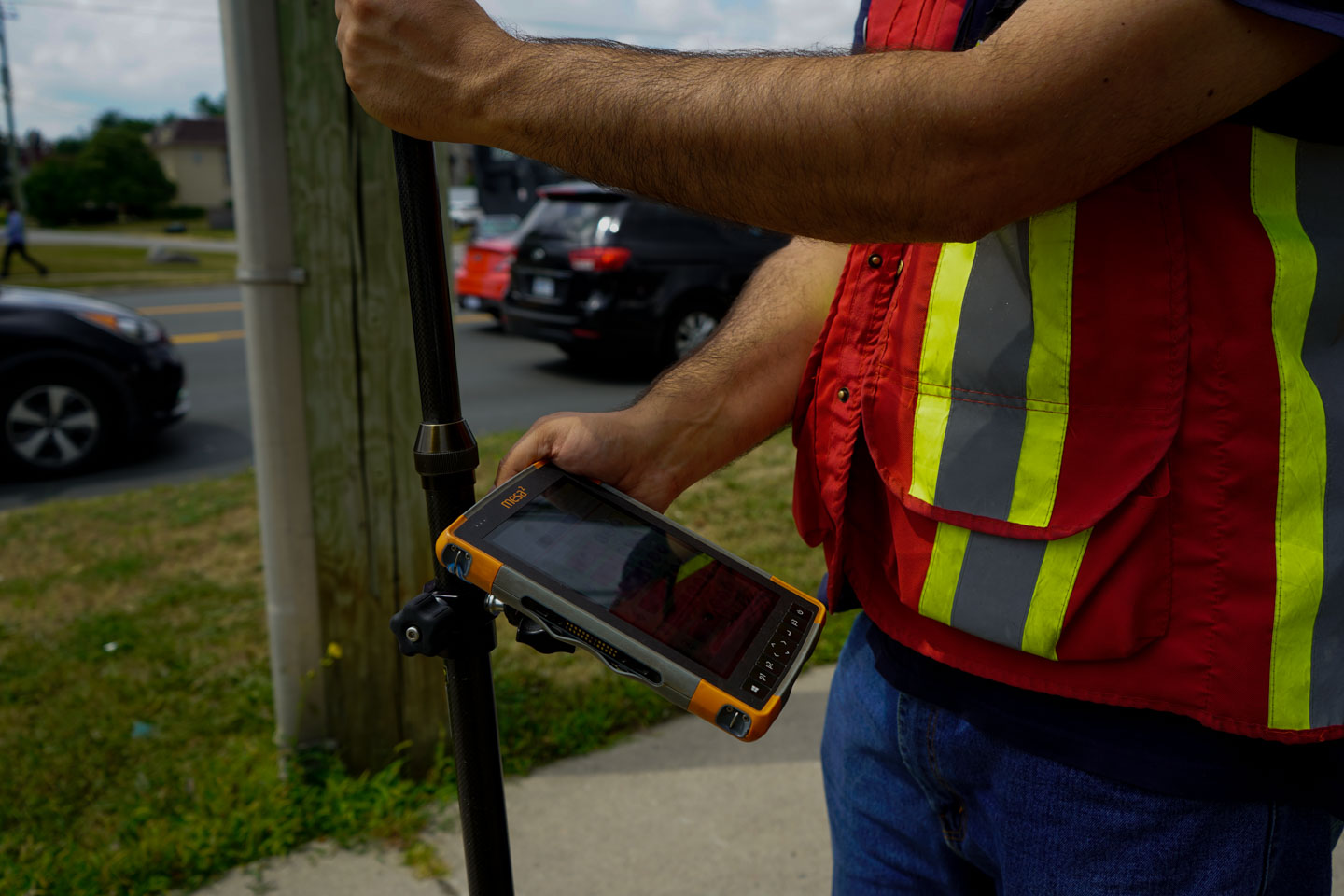
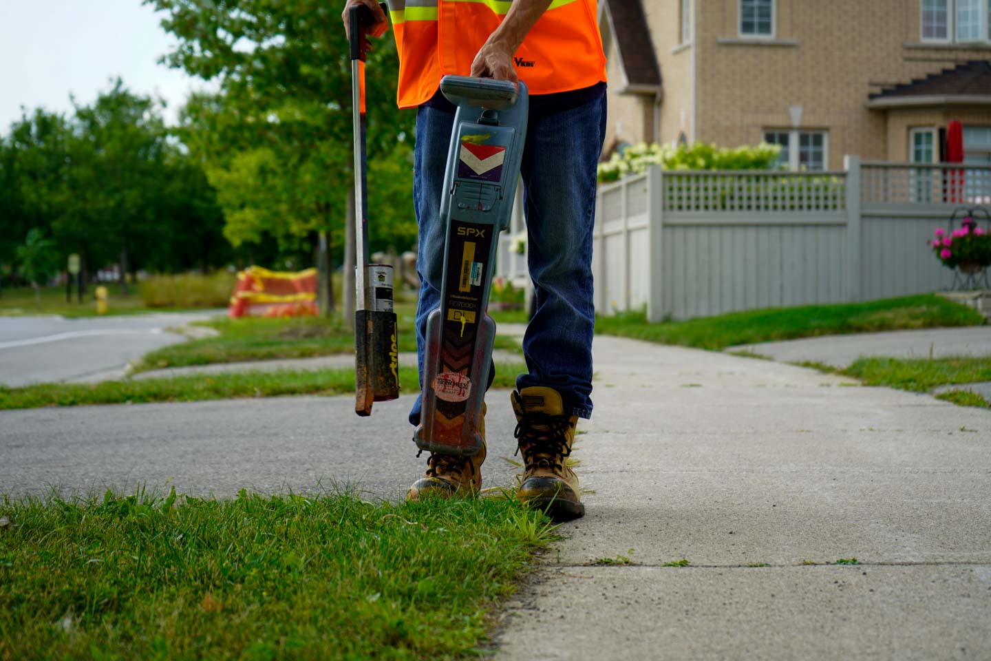
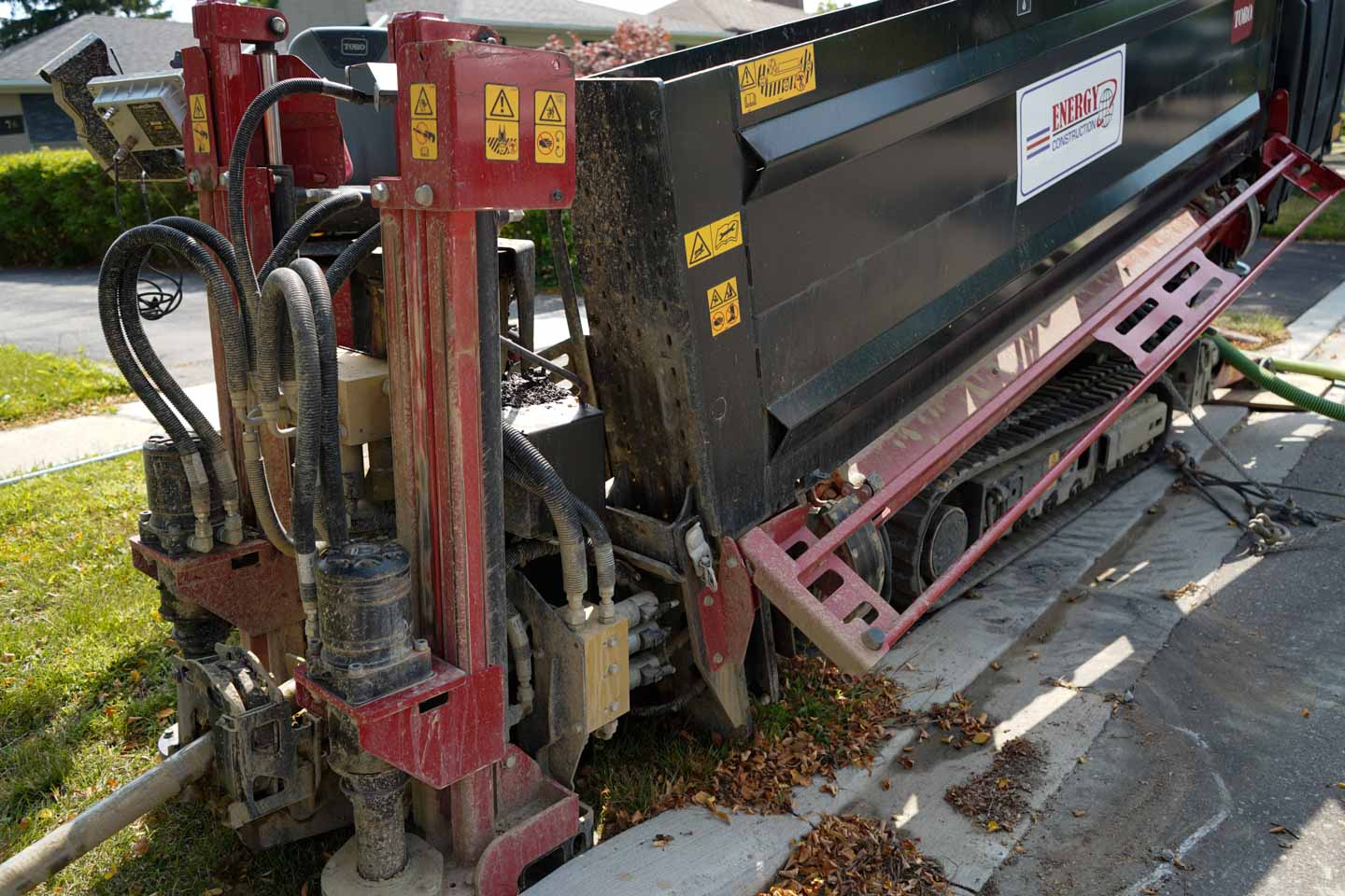
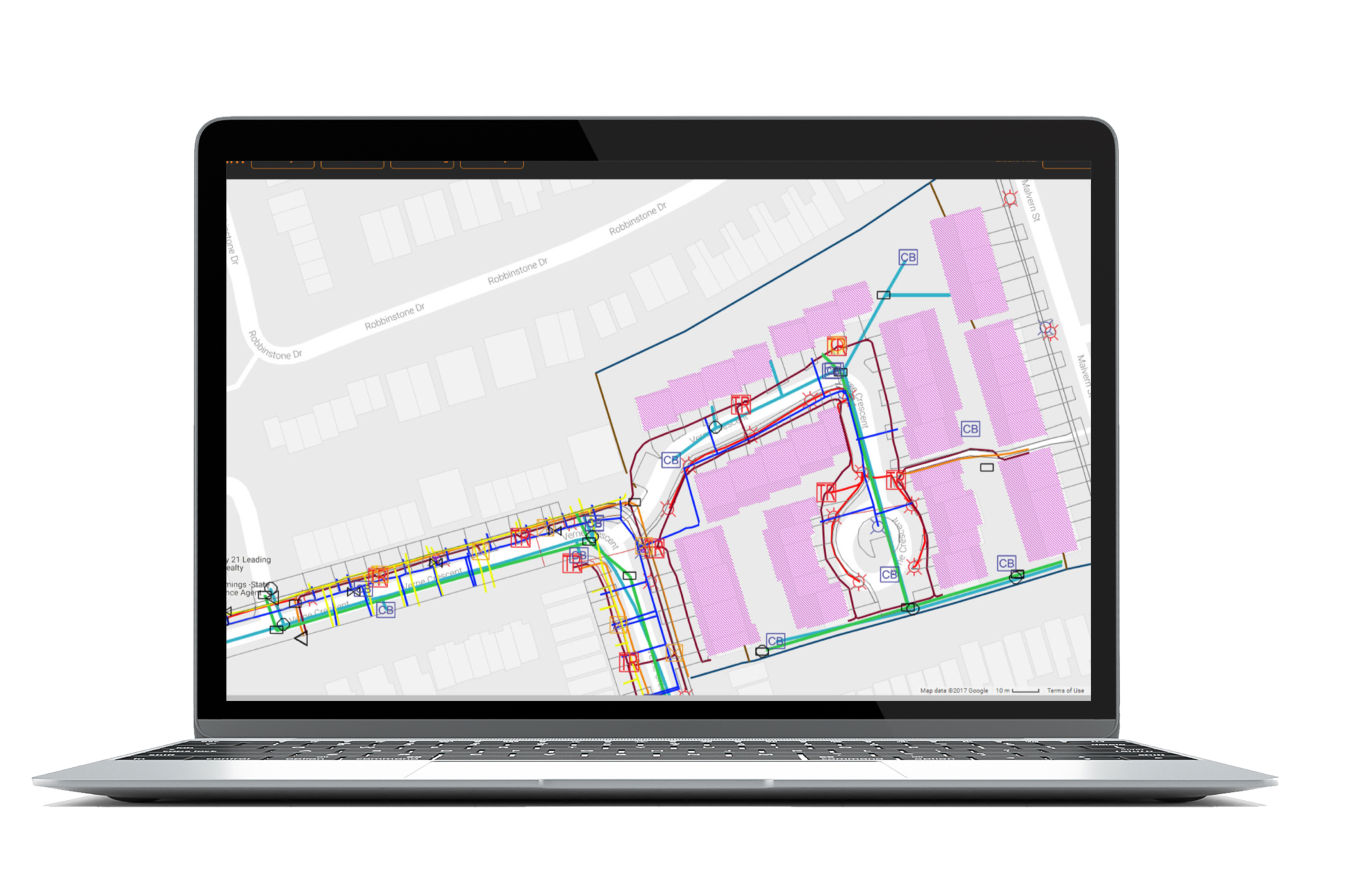
Smart city tech has already began to help municipalities deal with their ever-growing complexities. Through their utilization of data, Smart cities help municipalities respond to everyday situations. This data enables cities to measure resources, respond swiftly to a myriad of circumstances, and create a viable blue print for the future. For example, public works such as maintenance will become much more efficient with the ability to monitor the health of utilities and the location of serviceman in real-time. This will empower municipalities to make superior decisions and a play a more active role in shaping the city’s overall performance. Cities such as Singapore, London, New York, San Francisco, and Chicago, are already taking the helm in regards to smart city adoption and integration.

……….So what’s the problem?

There has been some backlash as to wether this is just another “tech-fad” and if this is  indeed something viable for cities. For decades we have been both skeptical and accepting of new developments in technology. This type of skepticism is nothing new and has been around for centuries. The printing press is a great example of this type of skeptical thinking. For those who don’t remember, the printing press was a device that allowed text and images to be transferred to paper by the means of ink. Before this invention, scribes produced writings and drawings paingstainkinly by hand. It seems obvious that this invention was immediately accepted….right?….wrong! Johannes Trithemius, a leading scholar in his time, predicted that the printing press would never last. In his essay “In Praise of Scribes”, he argued that handwriting was the moral superior to mechanical printing. It is obvious that Mr. Johannes’ luddite mentality did not prove correct; the printing press led to new mediums of communication and expression, making it one of the most influential inventions of the second millennium.

A more modern and mundane example is that of every single Apple keynote event. Apple will release either a new gadget or software and immediately people will take to social media and will try and discredit their innovations. Whether it comes from a vested interest, or just pure unadulterated skepticism, it is important to realize that this does not get us anywhere unless we adopt new forms of technology and do our part to help shape it. Software updates and new hardware is the result of people adopting and participating in these groundbreaking advancements. Just as we have trusted Google maps to help us get to our destination on time, and how we have trusted Siri to help us up set countless reminders, we must now put our trust in the new smart city domain.

We should revel in the fact that we are now presented with an an opportunity to participate in the next global technological revolution. If we are to be skeptical, lets use it as a point of discussion rather than one of discrediting. It is in our culture and genetics to adopt and adapt, and we should do so with open arms, by embracing smart cities and helping shape them the best we can.

– Ali Farhat, Writer, INTUS Smartcities

3rd Annual Security Project Conference: Cyprus 2018

“Archway” – A Smart Asset Management & Emergency Response System using Augmented Reality

Date: October 23, 2018
Location: Nicosia, Cyprus
Presented by INTUS Smartcities’ CEO Dimitris Agouridis


On October 23rd 2018, INTUS Smartcities’ CEO Dimitris Agouridis will present at the 3rd annual Security Project Conference taking place in Nicosia, Cyprus. The event aspires to highlight the ways in which the world can integrate security in smart cities and smart buildings. INTUS Smartcities is also a sponsor of this conference.

This conference focuses on the idea that Smart Cities and Smart Buildings are no longer a utopia, but a reality. The evolution of technologies focused around IoT and A.I., as well as the need to unify building equipment -either for large installations or even for home applications- has led the security sector towards to a new direction as well.

This annual conference will once more, be the most significant meeting place for security experts in Cyprus and everyone that has a general interest in this sector, participating in an event to learn, communicate, exchange knowledge and information, highlight thoughts, and get a chance at extroversion.

 The conference is scheduled to cover a wide range of subjects, with presentations by state institutions and speakers with experience and knowledge in various security sectors. At the same time, in the Conference area, an expo will take place, where relevant companies will present products, complete solutions and security services.

Mr. Agouridis will present INTUS Smartcities’ leadership in this “smart” field, including multiple initiatives pertaining to smart cities and smart buildings. These initiatives are primarily focused on infrastructure asset management, pipeline integrity management, emergency response systems and augmented reality technologies.

INTUS Smartcities technology, “Archway” (Patent Pending) is a cutting-edge system that allows users the ability to dynamically view each element of a structure using augmented reality. This technology has applications in building construction, building maintenance, as well as emergency response. It functions with two cases of structures: existing and new structure construction.

Augmented reality (AR) can dramatically change the way building construction, maintenance, and repairs are carried out, and emergency response is dramatically improved through infrastructure management. By mapping out what is behind each wall in a building, data can be integrated into applications for a number of uses.

A video demonstrating “Archway” in action can be seen below.

Learn more about the conference here.

“Phosphorus” Infrastructure Management System

“An integrated turn-key solution including: multi-use geospatial sensor management system, integration of remote sensors into a GIS based platform, and wide usability.”

“Phosphorus”, a sophisticated urban utility network management & monitoring system, provides real-time performance monitoring of various municipal assets/networks. Through GIS-based multi-sensor connectivity, this system has wide usability. Using GIS data, maps, and ‘as-builts’ collected through the different INTUS Smartcities’ services, functional elements of “Phosphorus” can be enabled, such as alert triggers and incident highlighting on GIS for emergencies.

Usability with:

  • Municipal Infrastructure (Street Lights, Sewer, Traffic Lights, Water etc.)
  • Utilities Network Infrastructure (Water, gas, Electricity etc.)
  • Oil and Gas (Pipeline Leak Detection)
  • Mining
  • Forestry
  • Road and Communication