Category

Uncategorized

Legacy Data Integration

Using geographic information is vital to understanding how a city operates. As of now, GIS is used to help cities around the world make better decisions in regards to maintenance and planning. However, many municipalities have either not digitally integrated their existing maps and/or not fully taking advantage of what GIS has to offer. With a lack of digital integration, municipalities are left with old or obsolete legacy data that can be difficult to access, provides little to no insight on how to maintain assets and plan for the future, and can actually cause serious safety concerns for communities. With the help of INTUS Smartcities, municipalities can get back on track and make use of these old data investments to better understand the geography of the communities serve. By understanding geography and a city’s relationship to location, municipalities are better equipped to make informed decisions about how we plan projects and maintain infrastructure within each community.

“Municipalities need a way to integrate data so that it can be analyzed as a whole and leveraged to make critical infrastructure decisions..”

What is GIS?

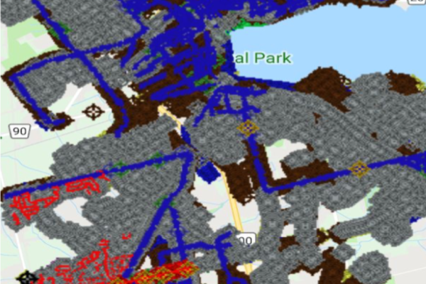
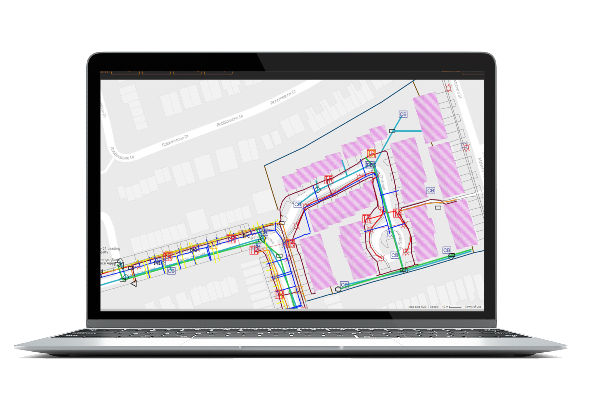
A geographic information system (GIS) integrates data for capturing, managing, analyzing, and displaying all forms of geographically referenced information. GIS allows users to visualize data in many ways that reveal relationships, patterns, and trends. These relationships help organizations like municipalities answer questions and solve problems in regards to planning and maintaining infrastructure.
Why GIS Integration?

All municipalities have new and legacy data stored in a variety of formats in many locations. Municipalities need a way to integrate data so that it can be analyzed as a whole and leveraged to make critical infrastructure decisions. Not only is this important to make decisions, but as asset networks become increasingly complicated, GIS becomes a vital tool to ensure safety for communities. For example, city workers could unknowingly cut an electrical line thus causing fires and power outages. Because municipalities have neglected digital integration, assets, projects and communities are at serious risk. However, thanks to its versatility, GIS can help municipalities avoid these issues.  By using its spatial component, GIS can highlight locations of infrastructure damage while also providing location services and route optimizations for field crews and Emergency responders. This saves tremendous time and money when it comes to infrastructure maintenance.

The INTUS Smartcities & GDIC Advantage

INTUS Smartcities & GDIC has the ability to preserve old data investments by integrating them into our proprietary GIS system. By utilizing our data translators, we are able to provide an array of legacy data migration and data conversion services, including data interoperability. Whether it is a paper map or an old CAD drawing, we will convert it into a digital format with quick turn-around. Our translators are designed to preserve accuracy, precision and attribution throughout the conversion process.

Data Integration

GDIC offers many types of mapping services in a wide variety of sectors including: Municipal Governments (Rural & Urban), Parks and Recreation, Agricultural, Utilities and Private Industry. Based on specifications, we can create different types of base maps.

Data Conversion

GDIC specializes in complex GIS file translations between digital spatial formats. If you have existing data in unusual or obsolete formats, you can preserve these data investments with accuracy and precision.

Data Collection

GDIC provides utility GPS mapping services and data collection services for Municipal planning and underground utilities (water, sewers, gas, etc.). GDIC Provides GPS mapping services of variable accuracy up to 1cm.

Data Hosting

GDIC can help host large amounts of data with our online server partnerships, alleviating the burden off of small municipalities.

Benefits of GIS Integration

Other than full digital representation, there are many benefits to choosing INTUS Smartcities for data/GIS integration

Increased Asset Data Integrity

Increased End-User Productivity

Lower Asset Data Maintenance Costs

Whatever your integration needs are, GDIC will ensure a smooth translation process, making sure each piece of data is handled with the utmost care and security. Thanks to our years of experience and cutting-edge software, we are able to complete data translations in a fraction of the time it takes our competitors. All data is then made accessible in an easy to format that has cross platform compatibility.  At INTUS Smartcities, we believe that data integration into Web-GIS is the first, and perhaps the most important, step in empowering city planners to make smarter decisions for the years to come.

Smart City Revolution: Adoption and Skepticism

Imagine a world that rejected to adopt new technology, a world without the steam engine, without railroads, or worst of all..… without a vacuum. These technologies have helped us dynamically evolve as a global community and drastically shape our lives. The smart city industry looks to continue this trend, which is something we should welcome and adopt with open arms.

We must understand that we are living in a world that is constantly innovating and reimagining itself through the use of technology. Technology has revolutionized the global economy and has been used as a critical competitive strategy. Technology has helped us overcome major hurdles of globalization pertaining to trade, ethics, mobilization, and information, thereby changing the market place. Technology is not something to be scared of, it is the lifeblood of globalization. New forms of technological integration, primarily smart cities, are constantly growing and shaping the way in which people live and how firms offer services. Smart Cities and their integration are aiming to alter the ways in which citizens interact with their city and how municipalities serve the citizenry. Smart Cities have already garnered much attention and have already reached a market valuation well into the trillions.

Smart city tech has already began to help municipalities deal with their ever-growing complexities. Through their utilization of data, Smart cities help municipalities respond to everyday situations. This data enables cities to measure resources, respond swiftly to a myriad of circumstances, and create a viable blue print for the future. For example, public works such as maintenance will become much more efficient with the ability to monitor the health of utilities and the location of serviceman in real-time. This will empower municipalities to make superior decisions and a play a more active role in shaping the city’s overall performance. Cities such as Singapore, London, New York, San Francisco, and Chicago, are already taking the helm in regards to smart city adoption and integration.

……….So what’s the problem?

There has been some backlash as to wether this is just another “tech-fad” and if this is  indeed something viable for cities. For decades we have been both skeptical and accepting of new developments in technology. This type of skepticism is nothing new and has been around for centuries. The printing press is a great example of this type of skeptical thinking. For those who don’t remember, the printing press was a device that allowed text and images to be transferred to paper by the means of ink. Before this invention, scribes produced writings and drawings paingstainkinly by hand. It seems obvious that this invention was immediately accepted….right?….wrong! Johannes Trithemius, a leading scholar in his time, predicted that the printing press would never last. In his essay “In Praise of Scribes”, he argued that handwriting was the moral superior to mechanical printing. It is obvious that Mr. Johannes’ luddite mentality did not prove correct; the printing press led to new mediums of communication and expression, making it one of the most influential inventions of the second millennium.

A more modern and mundane example is that of every single Apple keynote event. Apple will release either a new gadget or software and immediately people will take to social media and will try and discredit their innovations. Whether it comes from a vested interest, or just pure unadulterated skepticism, it is important to realize that this does not get us anywhere unless we adopt new forms of technology and do our part to help shape it. Software updates and new hardware is the result of people adopting and participating in these groundbreaking advancements. Just as we have trusted Google maps to help us get to our destination on time, and how we have trusted Siri to help us up set countless reminders, we must now put our trust in the new smart city domain.

We should revel in the fact that we are now presented with an an opportunity to participate in the next global technological revolution. If we are to be skeptical, lets use it as a point of discussion rather than one of discrediting. It is in our culture and genetics to adopt and adapt, and we should do so with open arms, by embracing smart cities and helping shape them the best we can.

– Ali Farhat, Writer, INTUS Smartcities

3rd Annual Security Project Conference: Cyprus 2018

“Archway” – A Smart Asset Management & Emergency Response System using Augmented Reality

Date: October 23, 2018
Location: Nicosia, Cyprus
Presented by INTUS Smartcities’ CEO Dimitris Agouridis


On October 23rd 2018, INTUS Smartcities’ CEO Dimitris Agouridis will present at the 3rd annual Security Project Conference taking place in Nicosia, Cyprus. The event aspires to highlight the ways in which the world can integrate security in smart cities and smart buildings. INTUS Smartcities is also a sponsor of this conference.

This conference focuses on the idea that Smart Cities and Smart Buildings are no longer a utopia, but a reality. The evolution of technologies focused around IoT and A.I., as well as the need to unify building equipment -either for large installations or even for home applications- has led the security sector towards to a new direction as well.

This annual conference will once more, be the most significant meeting place for security experts in Cyprus and everyone that has a general interest in this sector, participating in an event to learn, communicate, exchange knowledge and information, highlight thoughts, and get a chance at extroversion.

 The conference is scheduled to cover a wide range of subjects, with presentations by state institutions and speakers with experience and knowledge in various security sectors. At the same time, in the Conference area, an expo will take place, where relevant companies will present products, complete solutions and security services.

Mr. Agouridis will present INTUS Smartcities’ leadership in this “smart” field, including multiple initiatives pertaining to smart cities and smart buildings. These initiatives are primarily focused on infrastructure asset management, pipeline integrity management, emergency response systems and augmented reality technologies.

INTUS Smartcities technology, “Archway” (Patent Pending) is a cutting-edge system that allows users the ability to dynamically view each element of a structure using augmented reality. This technology has applications in building construction, building maintenance, as well as emergency response. It functions with two cases of structures: existing and new structure construction.

Augmented reality (AR) can dramatically change the way building construction, maintenance, and repairs are carried out, and emergency response is dramatically improved through infrastructure management. By mapping out what is behind each wall in a building, data can be integrated into applications for a number of uses.

A video demonstrating “Archway” in action can be seen below.

Learn more about the conference here.

Cyprus GasTech Exhibition 2018

“Pipeline Intelligence Through Digital Transformation”

Date: October 16-18, 2018
Location: Limassol, Cyprus
Presented by INTUS and INTUS Smartcities’ CEO Dimitris Agouridis and Dr. Muid Mufti, head of INTUS’s R&D


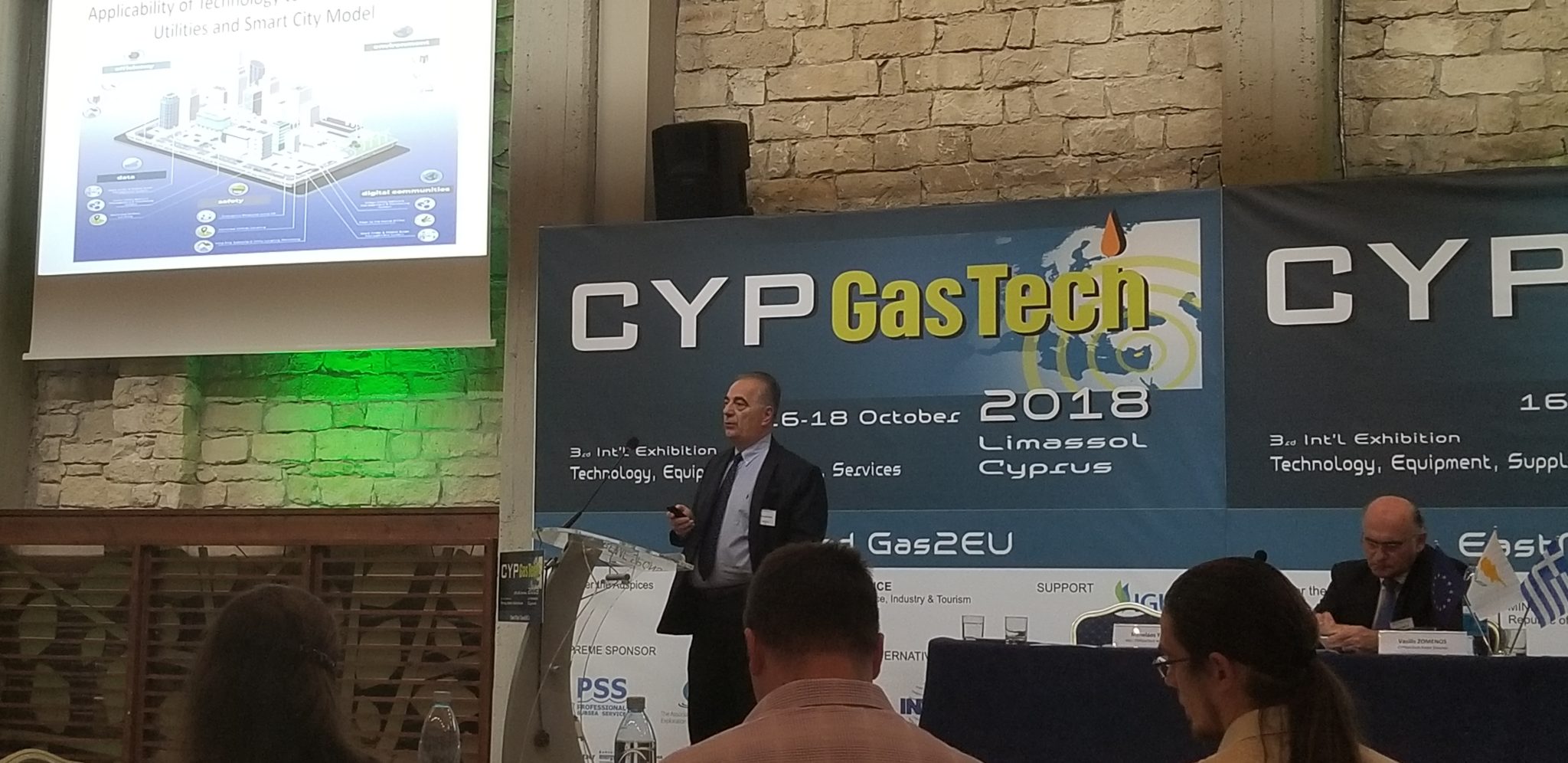
On October 16-18 2018, INTUS and INTUS Smartcities’ CEO Dimitris Agouridis, presented with Dr. Muid Mufti, head of INTUS’s R&D at the CYP Gas Tech 2018 event. The event was hosted in Limassol, Cyprus under the auspices of Ministry of Energy of Cyprus.

The two presented and reported the INTUS progress on the design and implementation of a ‘Pipeline Integrity System’ for improved monitoring and safety for gas transmission and gas distribution networks in both rural and urban environments. Agouridis emphasized how these installations are crucial assets for energy sustainability and economic development. It was stated that INTUS has engineered an effective digital pipeline system design called “BOSS” and brought it to life through a series of multifaceted technological advances. This system integrates a full cycle construction system and asset management system, as well as other INTUS advanced proprietary technologies such as 3D mapping and augmented reality.


It is INTUS’s mission “To ensure that all energy, communications, and vital services infrastructure is planned, built, maintained, accurately identified and efficiently managed in the safest and most cost-effective way possible!”

The location of this event, Limassol, is the second largest city of Cyprus, with the largest port, which is a major container transhipment centre in the Eastern Mediterranean, as well as a main stopover point for international cruises lines. The Limassol port handles more of two thirds of the total Cyprus imports/exports and is going to play a major role in the new energy era of Cyprus. Cyprus along with Greece, Israel, and Egypt are the main participants on the new gas pipeline network planned to provide Europe with secured gas alternatives supplies in the near future.

Learn more about the conference here.


“Phosphorus” Infrastructure Management System

“An integrated turn-key solution including: multi-use geospatial sensor management system, integration of remote sensors into a GIS based platform, and wide usability.”

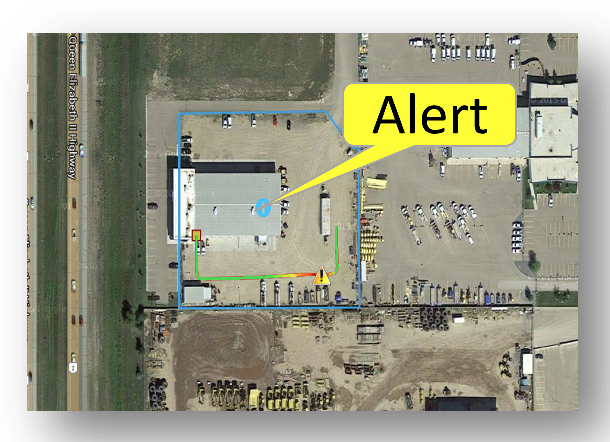
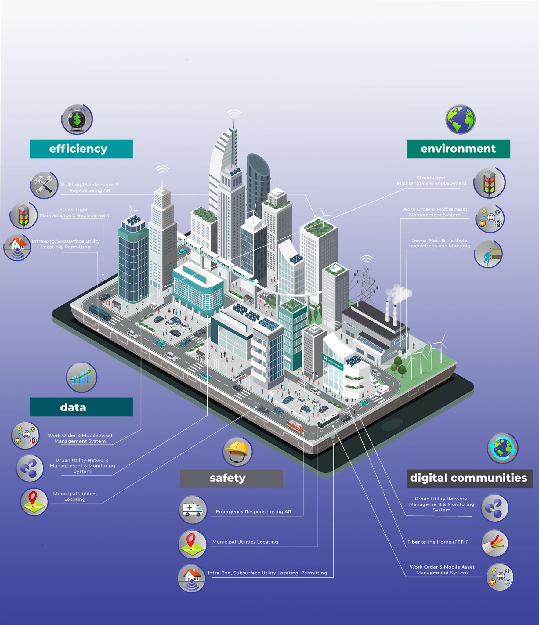
“Phosphorus”, a sophisticated urban utility network management & monitoring system, provides real-time performance monitoring of various municipal assets/networks. Through GIS-based multi-sensor connectivity, this system has wide usability. Using GIS data, maps, and ‘as-builts’ collected through the different INTUS Smartcities’ services, functional elements of “Phosphorus” can be enabled, such as alert triggers and incident highlighting on GIS for emergencies.

Usability with:

  • Municipal Infrastructure (Street Lights, Sewer, Traffic Lights, Water etc.)
  • Utilities Network Infrastructure (Water, gas, Electricity etc.)
  • Oil and Gas (Pipeline Leak Detection)
  • Mining
  • Forestry
  • Road and Communication

“24×7” Emergency Response with AR

“24×7 Is An Auxiliary System And Supporting Group That Assists Local Emergency Responders During Natural Disasters And Terrorists Attacks.”

The Approach

  • Immediate Migration of Infrastructure Data (preferably GIS Data) into a Remote Server accessible by Cloud Technologies.
  • Immediate migration of all Infrastructure Safety and Operations Training manuals on Cloud.
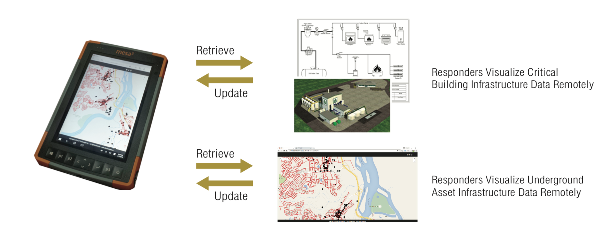
  • Provide Hand Held devices to all responders for viewing all GIS and Safety Procedures on a Geo-location model, with enabled two-way communication via these devices for full scale reporting from the field. (Damages, casualties etc.)
  • Implement GPS technology to all First Responders vehicles.
  • We can provide portable Emergency Response Center technologies and operational personnel
  • We can provide underground utility locators with Fault detection instrumentation to locate the damaged utilities. (power, telephone, fiber etc.)
  • We can provide Utility Repair personnel for immediate restoration of power, telephone, and internet in support with local utilities especially on high priority buildings (hospitals etc.).
  • We can involve 24×7 in advance of any situation by transferring Infrastructure Data into GIS and Web GIS.
  • We can integrate Building Infrastructure Plans and provide Emergency Exit Instructions visually on Android Hand-held devices.
  • 24×7 RRR will be extremely valuable instrument during restoration of infrastructure.

“ESDN” Data Integration & Web-GIS Hosting

“ESDN (Electronic Spatial Data Network) is a multi-layer GIS engine, capable of supporting geo spatial data in both vector and raster form.  ESDN is a fully functional Asset Management System.”

Each asset can be associated with multiple schemas of metadata including both instantaneous and historical data. A variety of additional documents like images, PDF files, and other binary files can be attached to an asset. This is available instantly on the web interface or though the machine to machine (M2M) interface. ESDN has a diverse date importing and exporting options like ESRI shape files, DXF, KML and ASCII data, etc. Online, ESDN has an accompanying desktop version for ease manipulating spatial data.

ESDN can accommodate the integration of all geo-referenced urban assets that hold value for the Town into a single GIS system, by linking all infrastructure components that share a common location within an identified multi-layer base-map. The integrated Urban Asset Management system incorporates any existing information that can be used to support effective financial planning, preventative maintenance and risk management programs currently in place.

Good asset management can maximize the benefits provided by infrastructure as it deals with the long-term perspective. It also gives the Town the opportunity to achieve cost savings by identifying decline early on so action can be taken to rehabilitate or renew the asset, or related assets found within the infrastructure corridor.

“Infra-Eng” Subsurface Utility Engineering & Permitting

“The Infra-Eng, or Infrastructure Engineering, method of subsurface utility locating and permit-generation- takes a mere two months versus the industry standard of one entire year.”

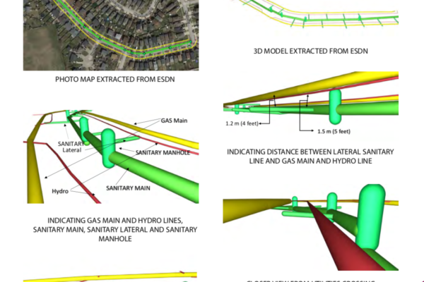
Infrastructure Pre-Engineering Service (InfraEng) is a full suite of Pre-Engineering services for Engineering companies in infrastructure, construction and Oil & Gas industries. This is more upscaled and integrated subsurface utility engineering (SUE) than the conventional SUE services. It starts with private locates, 3D geomatical and geophysical mapping, GIS enabled CADD and finally the Municipal Permit. The service provides accurate surface and depth GIS Data and Analysis which ranges from facilities and buildings, water and sewage, electricity, roads and railways, telecommunications and gas lines.

Infra-Eng combines the following in one pass:

  • Bringing engineering directly to the field
  • Integrating city maps as locating, mapping, surveying, and hydrovacing are completed

Infrastructure Engineering, or “Infra-Eng”, is the expedited process of subsurface utility engineering.

Subsurface Utility Engineering (known as SUE), is the collection of data in the form of ‘drawings’ to represent what is located subsurface in an area and is necessary to submit in order to acquire permits from a municipality (typically for utility installations). Normally, subsurface utility engineering focuses on gathering the data of four separate components- utility locating, mapping, surveying, and hydrovacing. Each of these components requires its own separate crew and then, data is passed along to an engineer before it can be submitted for a permit.

The data and ‘drawings’ required for a permit need to be updated from the original drawing (which is called an ‘as-planned’) every time something in the area is changed, or certain environmental elements/vital infrastructure are found . Each change to the original ‘as-planned’ is called an ‘as-built’.  As can be imagined, this entire process is costly and timely. The typical time it takes to receive a permit with this current process is roughly a year.

Infra-Eng will be applied by INTUS Smartcities as a solution to the long and inefficient process of subsurface utility locating and acquisition of permits. With that know-how and crews, INTUS Smartcities can complete the entire process of subsurface utility engineering in one pass, bringing the engineering directly to the field, integrating city maps as locating, mapping, surveying, and hydrovacing are completed (instead of passing the data along to an engineer).

“INTUSLINK” ORP System

“INTUSLINK and Archway work hand-in-hand to advance construction and asset development & management.”

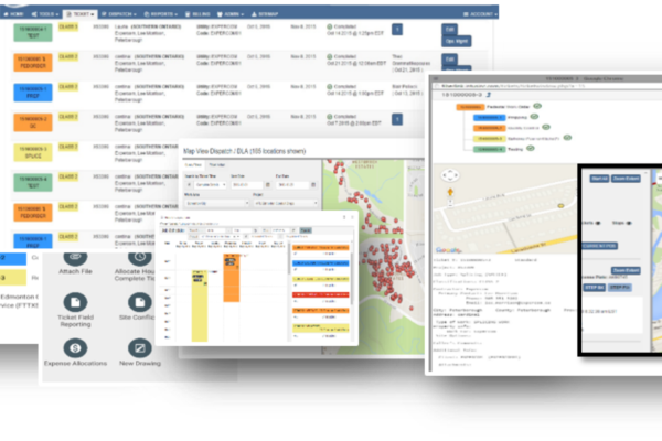
INTUSLINK is an Operations Resources Planning (ORP) system for asset development, construction and asset management. The system facilitates real-time field reporting tools including online progress reports on partial completion of projects, as well as supports the integration of elements such as repair records and associated maintenance costs.

INTUSLINK has multiple build-in modules such as:

  • Inventory Mobile Asset Management
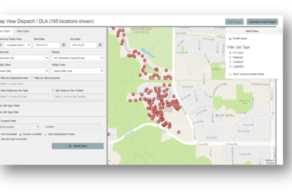
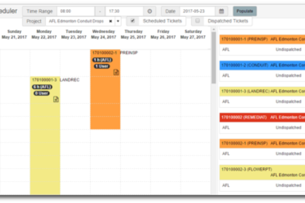
  • Field Crew Scheduling
  • Performance & Cost Tracking
  • Network Asset Management Permitting
  • And more, all visually accessible via an advanced AR environment

INTUSLINK provides state-of-the-art progress reporting.

“INTUSlink” allows for online partial completion and progress reports for each project and enables management to efficiently monitor productivity, budget & timelines at all times through the construction & asset development layer. Work progress can be displayed on a GIS or AR environment while automated notifications can be activated for each task or group of tasks. Labor and other associated cost figures and percentages are available and can be shared with management to allow for an effective cost control.