Category

ER & Public

3rd Annual Security Project Conference: Cyprus 2018

“Archway” – A Smart Asset Management & Emergency Response System using Augmented Reality

Date: October 23, 2018
Location: Nicosia, Cyprus
Presented by INTUS Smartcities’ CEO Dimitris Agouridis


On October 23rd 2018, INTUS Smartcities’ CEO Dimitris Agouridis will present at the 3rd annual Security Project Conference taking place in Nicosia, Cyprus. The event aspires to highlight the ways in which the world can integrate security in smart cities and smart buildings. INTUS Smartcities is also a sponsor of this conference.

This conference focuses on the idea that Smart Cities and Smart Buildings are no longer a utopia, but a reality. The evolution of technologies focused around IoT and A.I., as well as the need to unify building equipment -either for large installations or even for home applications- has led the security sector towards to a new direction as well.

This annual conference will once more, be the most significant meeting place for security experts in Cyprus and everyone that has a general interest in this sector, participating in an event to learn, communicate, exchange knowledge and information, highlight thoughts, and get a chance at extroversion.

 The conference is scheduled to cover a wide range of subjects, with presentations by state institutions and speakers with experience and knowledge in various security sectors. At the same time, in the Conference area, an expo will take place, where relevant companies will present products, complete solutions and security services.
Mr. Agouridis will present INTUS Smartcities’ leadership in this “smart” field, including multiple initiatives pertaining to smart cities and smart buildings. These initiatives are primarily focused on infrastructure asset management, pipeline integrity management, emergency response systems and augmented reality technologies.

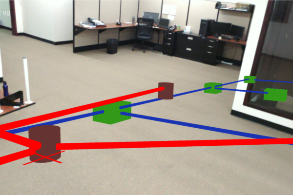
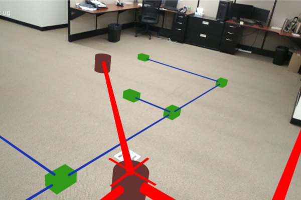
INTUS Smartcities technology, “Archway” (Patent Pending) is a cutting-edge system that allows users the ability to dynamically view each element of a structure using augmented reality. This technology has applications in building construction, building maintenance, as well as emergency response. It functions with two cases of structures: existing and new structure construction.

Augmented reality (AR) can dramatically change the way building construction, maintenance, and repairs are carried out, and emergency response is dramatically improved through infrastructure management. By mapping out what is behind each wall in a building, data can be integrated into applications for a number of uses.

A video demonstrating “Archway” in action can be seen below.

Learn more about the conference here.

“Phosphorus” Infrastructure Management System

“An integrated turn-key solution including: multi-use geospatial sensor management system, integration of remote sensors into a GIS based platform, and wide usability.”

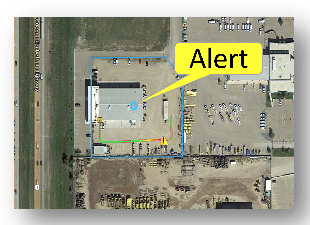
“Phosphorus”, a sophisticated urban utility network management & monitoring system, provides real-time performance monitoring of various municipal assets/networks. Through GIS-based multi-sensor connectivity, this system has wide usability. Using GIS data, maps, and ‘as-builts’ collected through the different INTUS Smartcities’ services, functional elements of “Phosphorus” can be enabled, such as alert triggers and incident highlighting on GIS for emergencies.

Usability with:

  • Municipal Infrastructure (Street Lights, Sewer, Traffic Lights, Water etc.)
  • Utilities Network Infrastructure (Water, gas, Electricity etc.)
  • Oil and Gas (Pipeline Leak Detection)
  • Mining
  • Forestry
  • Road and Communication

“24×7” Emergency Response with AR

“24×7 Is An Auxiliary System And Supporting Group That Assists Local Emergency Responders During Natural Disasters And Terrorists Attacks.”

The Approach

  • Immediate Migration of Infrastructure Data (preferably GIS Data) into a Remote Server accessible by Cloud Technologies.
  • Immediate migration of all Infrastructure Safety and Operations Training manuals on Cloud.
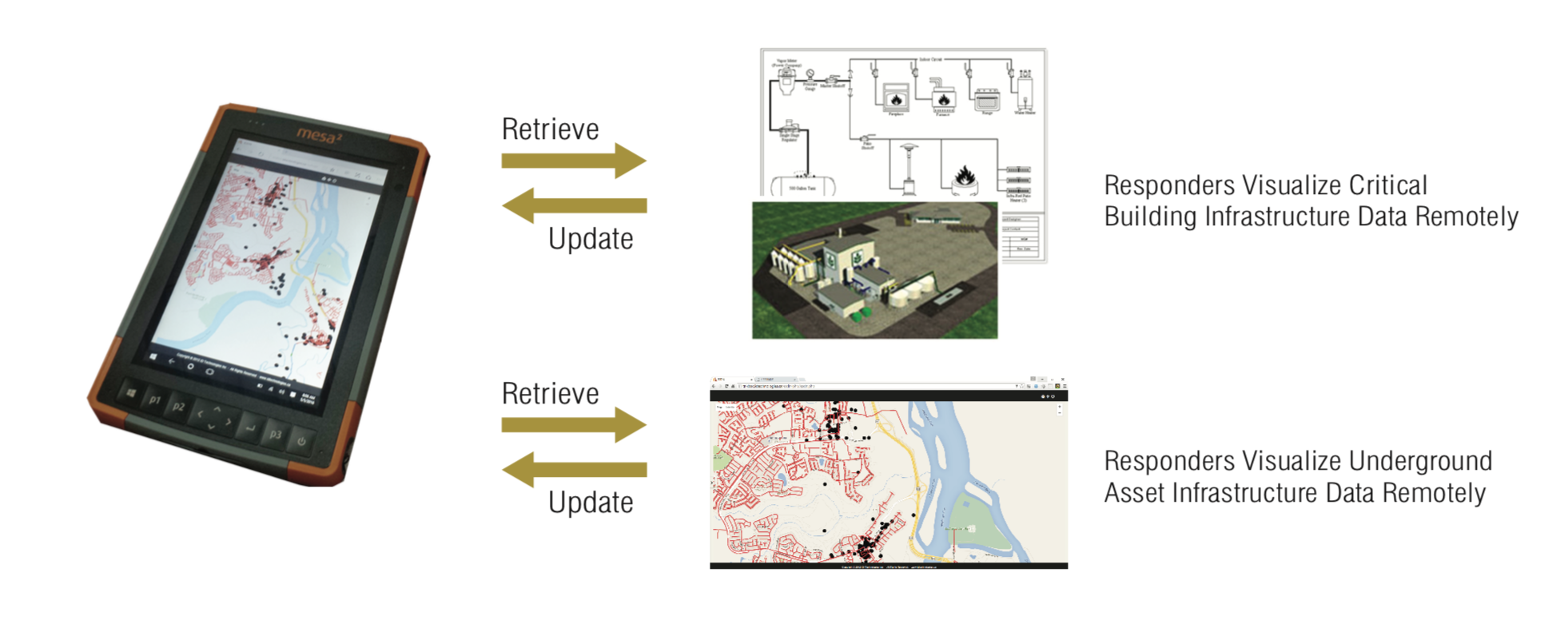
  • Provide Hand Held devices to all responders for viewing all GIS and Safety Procedures on a Geo-location model, with enabled two-way communication via these devices for full scale reporting from the field. (Damages, casualties etc.)
  • Implement GPS technology to all First Responders vehicles.
  • We can provide portable Emergency Response Center technologies and operational personnel
  • We can provide underground utility locators with Fault detection instrumentation to locate the damaged utilities. (power, telephone, fiber etc.)
  • We can provide Utility Repair personnel for immediate restoration of power, telephone, and internet in support with local utilities especially on high priority buildings (hospitals etc.).
  • We can involve 24×7 in advance of any situation by transferring Infrastructure Data into GIS and Web GIS.
  • We can integrate Building Infrastructure Plans and provide Emergency Exit Instructions visually on Android Hand-held devices.
  • 24×7 RRR will be extremely valuable instrument during restoration of infrastructure.

“Archway” Augmented Reality (Patent Pending)

“Archway will reform building construction, maintenance, and repairs, as well as revolutionize emergency response.”

Archway (Patent Pendingis a cutting-edge system that allows users the ability to dynamically view each element of a structure. This technology has applications in building construction, building maintenance, as well as emergency response. It functions with two cases of structures: existing and new structure construction.

Augmented reality (AR) can dramatically change the way building construction, maintenance, and repairs are carried out, and emergency response is dramatically improved through infrastructure management. By mapping out what is behind each wall in a building, data can be integrated into applications for a number of uses.

Archway is comprised of a three-layer process:

1. Asset Development & Construction

2. Asset Maintenance & Repairs

3. Emergency Response with Augmented Reality (AR)

In layer 1, Asset Development & Construction, CAD Design files can provide the base for new project construction management. All building elements are imported into another system, called “INTUSLINK”, and itemized. “INTUSLINK” is the Operations Resource Planning (ORP) system which provides all work order functionality, partial completion project monitoring, cost management and inventory controls. The final deliverable of this layer is a 3D structure model.

In layer 2, Asset Management & Repairs, existing structures can be integrated into the Archway system by means of 3D laser scanner technology. Once a 3D model is created of a structure, all schematics of the building are integrated into the system. This includes: underground utilities, above ground utilities (in walls, etc.), doors, windows, and other important structural elements.

In layer 3, Emergency Response with Augmented Reality, all emergency related health & safety processes, evacuation pathways, exits and equipment operational manuals are included as assets in the final product. Upon completion of the project, a “24×7″ emergency response phone application, using AR tools can be downloaded by all structure/building employees and anyone visiting the structure. This application can be used to guide and assist anyone inside in case of emergency as well as emergency response crews.

Archway provides four key features:

  • Online Data Integrity & Security

  • Optimized Data Presentation

  • Additional Data Access

  • Data Organization

Online Data Integrity & Security:  Data is presented in interactive 3D environment, and only authorized users can view and edit data. Data is properly organized to maintain its integrity.

Optimized Data Presentation: Data is presented as layers, and each layer has its own presentation features which are customizable by member administrators. The layer presentation can be customized with respect to zoom level (i.e. different colour schemes for different zooms) and the amount of data downloaded is optimized for the field of view.

Additional Data Access: Authorized users can view and update the additional information of a particular object.

Data Organization: Data is properly organized in a hierarchy, composed of 1. Data Sets > 2. Layers > 3. Objects. Every member can control the layers, data in layers, data sets and layers in data sets.